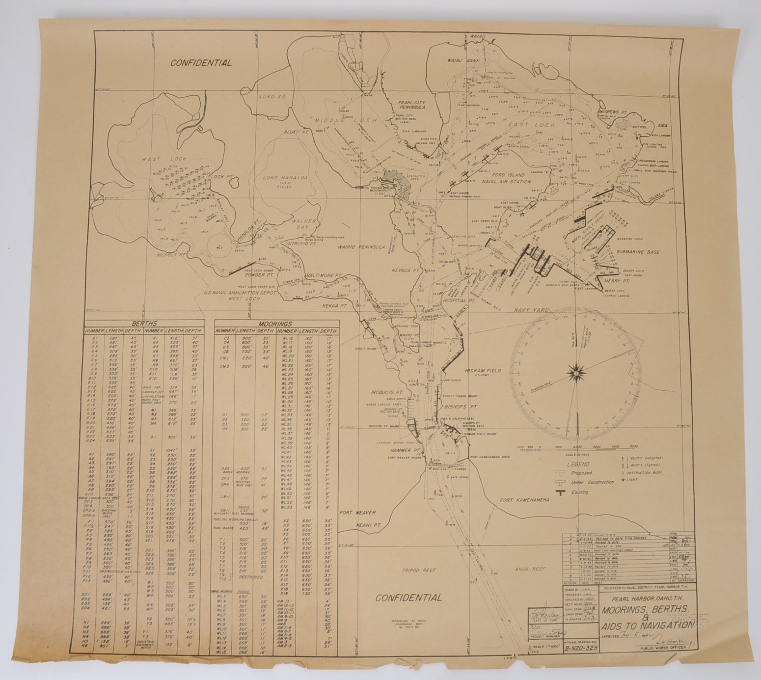
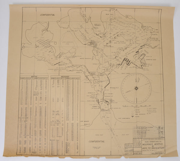
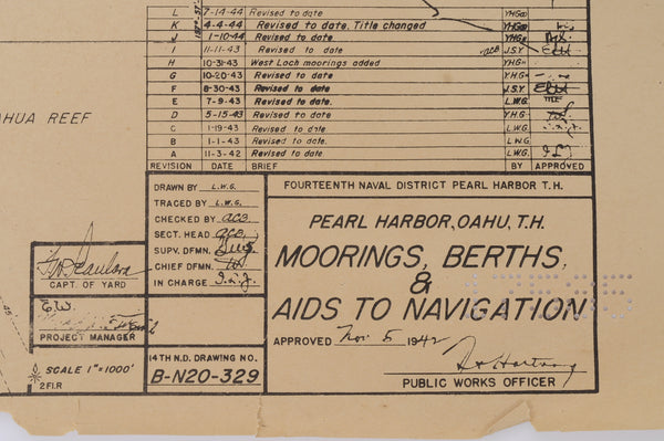
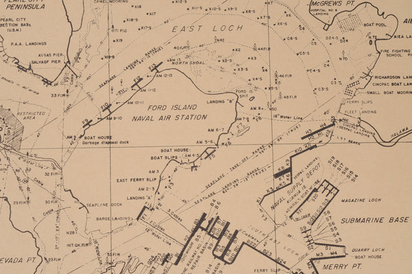
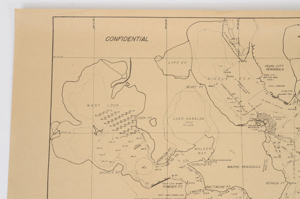
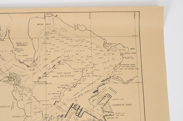
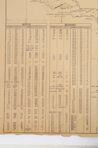
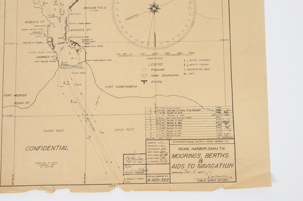
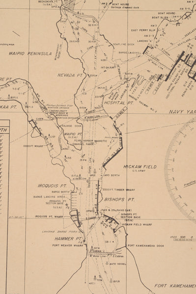
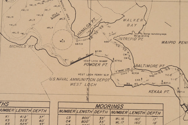
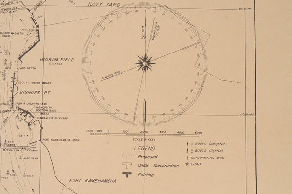
From the estate of a WWII Seabee... An amazing survivor! A "CONFIDENTIAL" chart of Pearl Harbor, Oahu TH. titled "Moorings, Berths & Aids to Navigation". Measures 20" x 18". Originally produced Nov 3, 1942. Last revision is July 14, 1944. Shows some overall wear from use and yellowing from age. Bottom edge is bent and chipped. Features all areas of the base including Hickam Field, Submarine Base, Ford Island Naval Air Station, etc. Of note are the resting places of the USS Arizona (F7), USS Utah (F11), and USS Oklahoma (WL6-WL7). Shows all moorings and berths with their lengths and depths as well as channel depths and obstructions. Also marked are Seaplane lanes, cables, etc. It was stored flat in a footlocker and has never been folded. Shipped flat and well protected in flat box with bubble wrap protection. A great addition to any collection!!
Most items are shipped via USPS Priority Mail the next business day. Items weighing more than 4 pounds may be shipped via USPS Priority Mail, USPS Parcel Select, or FedEx Ground depending on transit time and cost. Shipping rates are based on size, value, and weight of the item purchased. Shipping starts at $5.00.
